F1tenth
ROS 2 autonomy stack for a 1/10th-scale racecar with localization, planning, and control.
Recent Participations
| Event | Year | Placement |
|---|---|---|
| RoboRacer IV IEEE | 2026 | 7th |
Vehicle Platform
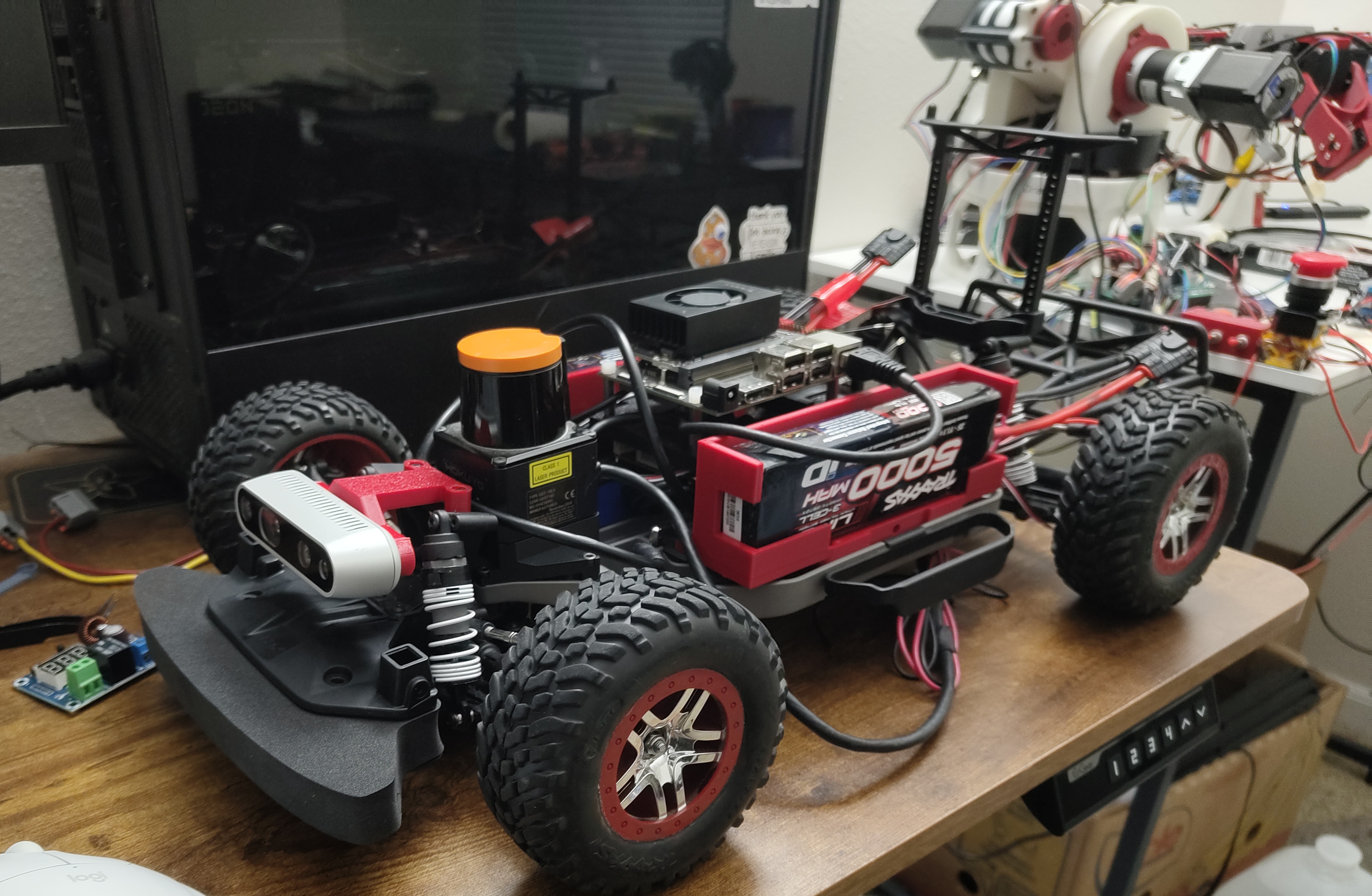
| Chassis | Traxxas Slash 4x4 |
|---|---|
| Compute | Jetson Orin Nano |
| Motor Controller | Trampa VESC |
| Camera | Intel RealSense 435i |
| Lidar | UTM 30LX (image shows UST 10LX) |
| Mounts | Custom designed, 3D printed |
Localization
Localization combines LiDAR observations with odometry to estimate the racecar's pose on a known map. We use the MIT Racecar particle filter as the core localization method, maintaining and scoring multiple pose hypotheses against the observed scan. An Extended Kalman Filter provides an odometry-informed state estimate to the particle filter, which produces the final localization output and remains robust when wheel odometry becomes unreliable or accumulates drift.
Planning and Control
Mapping and gap-following produce a seed path during track exploration; a raceline generator refines this path into an initial optimal trajectory. The primary controller uses Frenet-frame MPC with a kinematic bicycle model, curvature-based speed estimation, and a confidence metric adapted from lap-to-lap tracking error. This design supports fast, reliable operation in known, high-friction environments. A sampler-based MPCC, inspired by MPPI, remains under development, using a dynamic bicycle model, RK4 forward rollouts, a 0.8-second prediction horizon, and contouring and progress costs that account for obstacle interactions, supporting more capable decisions under slip and around obstacles. Feel free to reach out to me for additional details.
Obstacle Handling
Obstacle detection begins by filtering LiDAR measurements with a two-state Kalman filter to detect nearby opponents and estimate their velocity. Gaussian regression then refines the predicted opponent trajectory, allowing an optimal overtake point to be selected; a rerouting stage modifies the reference path for the MPC. The sampler-based controller handles this more directly by transforming LiDAR observations into the map frame and incorporating an additional LiDAR-derived cost, making obstacle awareness inherent to trajectory evaluation. Contouring costs further balance progress, rejoining the optimal path, and contouring error during obstacle avoidance.